Chillagoe Gold Project – QLD
Overview
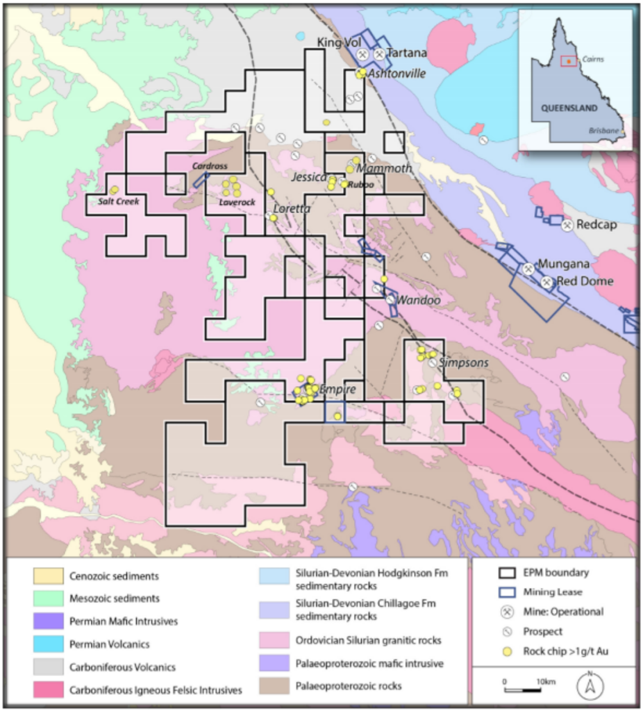
The Project is approximately 2 hours drive west of Cairns and comprises 6 EPMs (Exploration Permit for Minerals). The area covered (593km2) lies 30km west of Chillagoe and near the Mungana, Red Dome and King Vol mining operations. The principal target type in the area is Intrusion Related Gold (IRG) deposits which are typically associated with felsic Carboniferous breccia pipe and intrusive complexes. In this area several such bodies are known and display features typical of the nearby Red Dome and Mungana IRG deposits.

Exploration Program
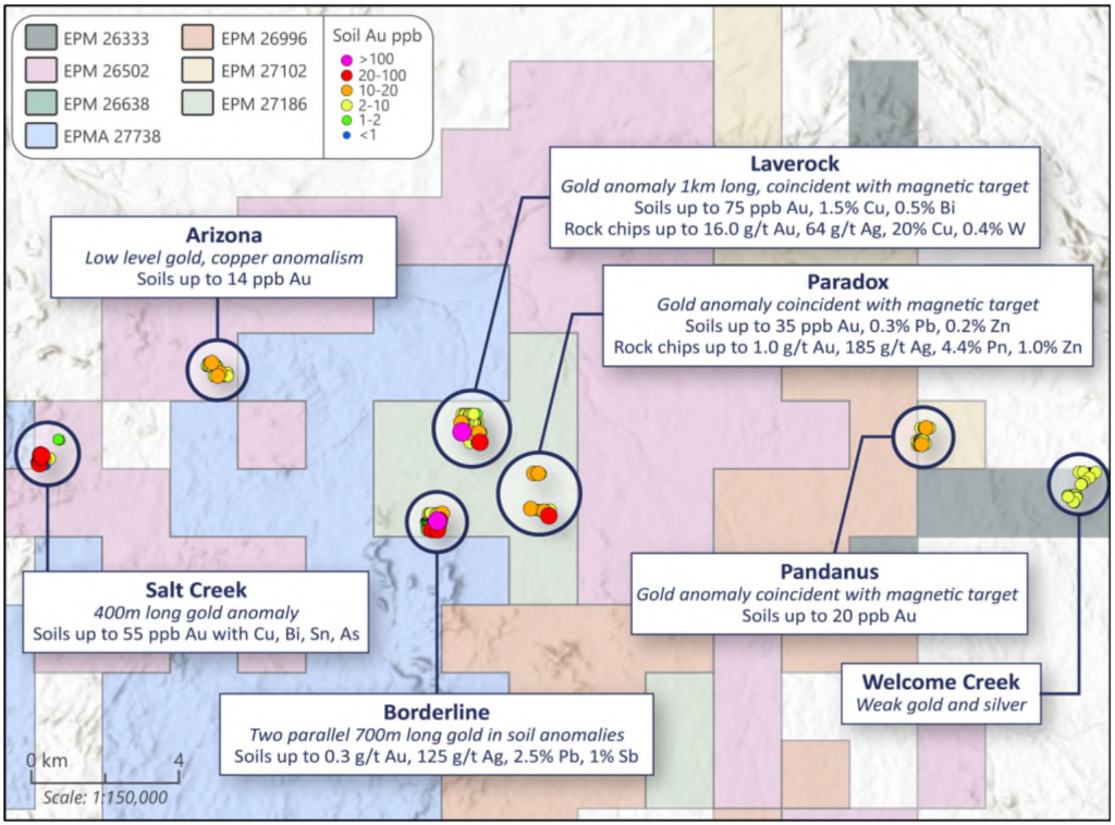
A total of 466 shallow soil samples were collected across eight selected targets in Oct/Nov 2020. Holes were drilled using a trayback mounted soil auger drill at 20m intervals across mineralised trends or magnetic anomalies. They were drilled to solid basement and an end-of-hole sample collected. The average depth across all 466 samples was 1.2m, which was shallower than expected and indicates limited dispersion of anomalies.
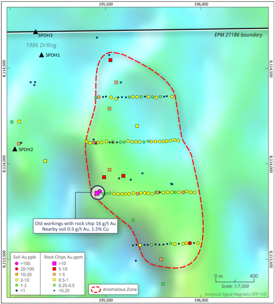
Thomson Resources identified a 1km long magnetic anomaly in the southern part of the area and four lines of auger sampling took place across it. At the end of one of the lines was a shallow old pit which had visible copper mineralisation. This rock chip assayed 16.0 g/t Au, 64 g/t Ag, 20% Cu, W 0.4%. Anomalies occurred on all four soil sampling lines with up to 75 ppb Au, Cu 1.5%, Bi 0.5%.


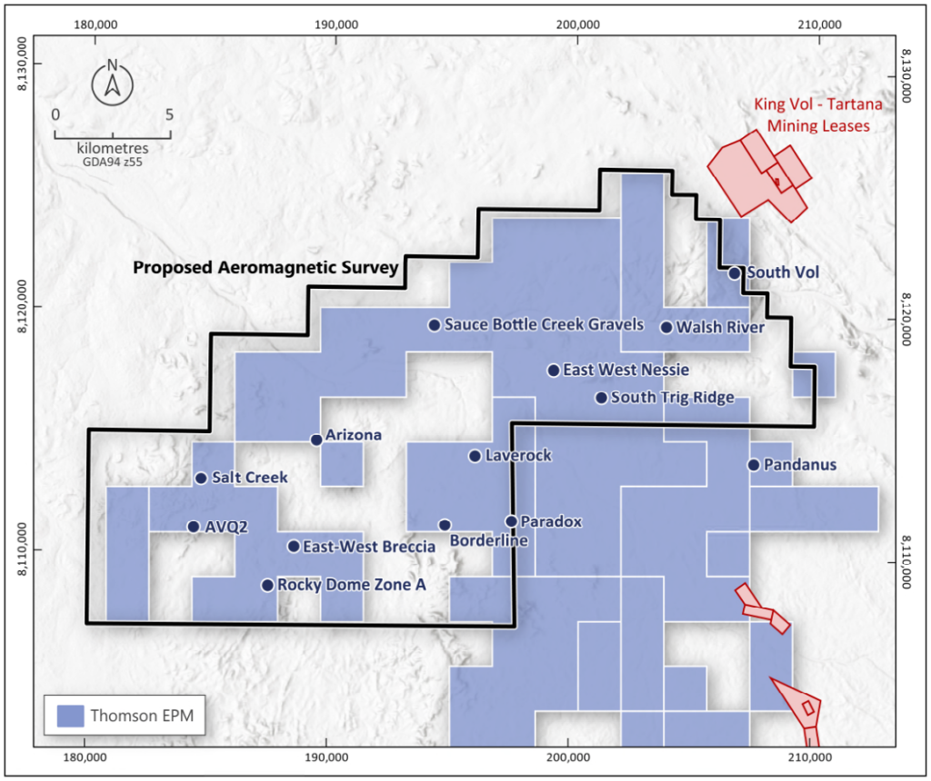
In April 2022 Thomson undertook a 3,000-line kilometre high resolution airborne magnetic survey to help define intrusion related mineralisation targets. The Survey has been partially funded by a grant of $100,000 by the Queensland Government under Round 4 of the Collaborative Exploration Initiative.

